Drive to Taplejung, then trek via Mitlung, Chirwa and Sekathum up the Ghunsa Khola valley, gaining altitude gradually over 3 days.


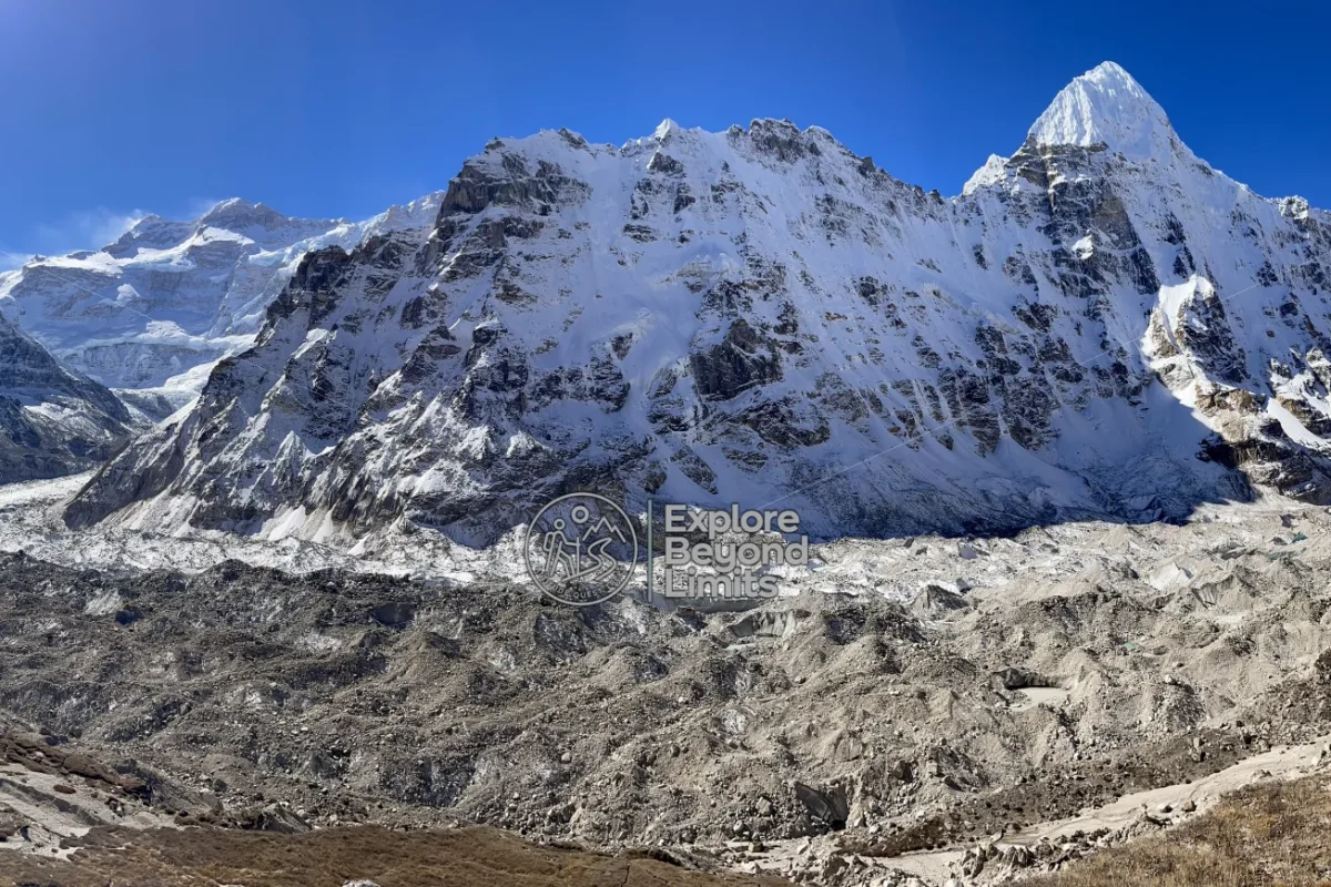
The Kanchenjunga Base Camp trek is a 20-day restricted-area trek in far eastern Nepal, visiting both North Base Camp (Pangpema, 5,140m) and South Base Camp (Oktang, 4,730m) at the base of the world's third-highest mountain. It suits experienced trekkers comfortable with remote, camping-supported travel. Full route and permit details are below.
The Kanchenjunga Base Camp trek is one of the genuinely remote treks left in Nepal. There's no teahouse chain here like in the Khumbu or Annapurna; you're walking through a restricted conservation area with a licensed guide by law, camping and eating what the crew carries in.
Nepal's government requires a minimum of two trekkers and a registered agency for this route, which keeps crowding down. According to the Nepal Tourism Board's own trekking data, Kanchenjunga sees a small fraction of the annual permits issued for Everest or Annapurna.
| Detail | Info |
|---|---|
| Duration | 20 days (trek only, Taplejung to Taplejung) |
| Max altitude | 5,140m (Pangpema, North Base Camp) |
| Difficulty | Strenuous, remote, camping-supported, 5 to 7 hours walking most days |
| Best season | April to May, October to November |
| Group size | 2 to 10 people, minimum 2 by restricted-area rule |
| Price basis | Per person, full camping support included |
| Permits required | Restricted Area Permit and Kanchenjunga Conservation Area Permit |
This one needs real planning ahead, since permits and crew booking take time. Email contact@aqtreks.com or visit aqtreks.com to start.
Drive to Taplejung, then trek via Mitlung, Chirwa and Sekathum up the Ghunsa Khola valley, gaining altitude gradually over 3 days.
Rest day in this Tibetan-influenced village before the higher, harder stretch north.
Through Phole and past avalanche-prone slopes to Khambachen, with a rest day here too before Lhonak.
Along the Kanchenjunga Glacier’s lateral moraine, exposed and rocky, with a second acclimatisation day at Lhonak.
The trek’s high point: a full day out to Pangpema for the closest legal view of Kanchenjunga’s north face, then back to Lhonak.
Back down to Ghunsa, then over the Sele La pass system (around 4,290m) to reach the southern side of the range at Cheram.
A shorter day to Ramche, with the Oktang viewpoint for South Base Camp reached from here.
Descend through Tortong and over the Lasiya Bhanjyang ridge to Yamphudin, dropping back into forested, inhabited terrain.
Final descent and drive back to Taplejung, with a built-in buffer day for the region’s occasional road delays.
April and May give you rhododendron forest at the lower elevations and generally settled weather higher up. October and November are drier and colder but sharper for photos. We're honest with guests that this isn't a trek to attempt outside those two windows; winter snow closes the high passes and monsoon makes the lower trail genuinely dangerous.
Check conditions on Windy.com before committing to dates, since the Sele La crossing in particular is weather-sensitive.
You'll need a Restricted Area Permit (USD 20 per person per week for the first four weeks) plus the Kanchenjunga Conservation Area Permit (a flat NPR 2,000). No separate TIMS card is required since the Restricted Area Permit covers that. Nepali law requires a minimum of two trekkers and a licensed agency for this route; solo independent trekking isn't legally possible here.
This is genuinely remote. There's no phone signal for most of the route and the nearest real medical support is a flight away. Our guides are trained in altitude assessment and carry a satellite communicator. For general trekking safety guidance, see the Himalayan Rescue Association, and check DHM Nepal for regional forecasts before you fly to Taplejung.
Interested? Email contact@aqtreks.com or book at aqtreks.com.
No fixed departure dates published yet for this trek — send us an enquiry for a private departure.
No reviews yet for this trek.
Per person
Total
Keep exploring